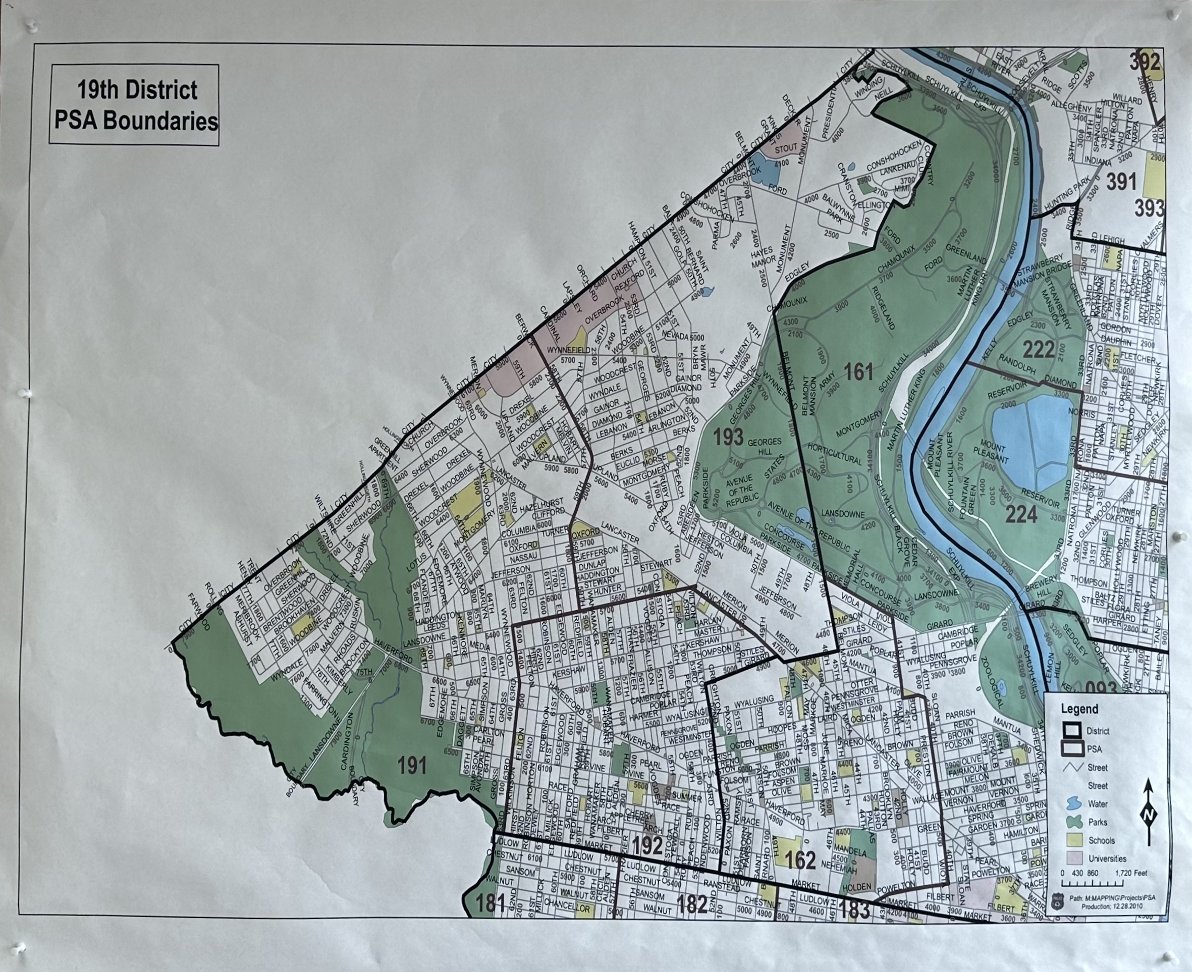
Philadelphia Police Department 19th District PSA Map
In the 19th District, there are 3 Police Service Areas (PSAs). Each is a part of neighborhood policing, a strategy that focuses on community engagement and increasing the quality of life for all Philadelphians. This map is found in the Reception Area of the 19th District, 6059 Haverford Avenue.
Introduction. The Police Service Area (PSA) is an effort to refine our foundation of delivering basic police services by police districts personnel. The districts and their personnel are given broad guidelines contained in this directive. It is their job to create and test the means and methods that will turn the PSAs from concept into reality. Through these tests we will learn what works and what does not and may discover something new. Understand and challenge what is being asked of you and then work with us to make a basic principle in policing -geographic accountability – a meaningful basis for changing the way the Philadelphia Police Department does policing.
Police Service Areas (PSAs) are part of neighborhood policing, a strategy that focuses on community engagement and increasing the quality of life for all Philadelphians. The area that forms a PSA is based off of the city’s 21 police districts. Each of these districts is then broken up into two to four smaller geographical subdivisions, the PSAs.